The spit in numbers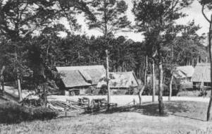
(from 1935)
Geography |
|
| Length of
the spit: |
97 km |
| Most narrow spot: | 4 km (north from Nidden) |
| Highest points:
|
Predin 72 m |
| Nidden, High Dune 63 m | |
| Nidden, Lighthause hill 51 m | |
| Width at the base of the dune: | 300, 400-600 m |
| Average migration: | 2 to 8 m annual |
| Average rainfall amounts : | 521 mm |
Courland Lagoon |
|
| Size: | 1613 square km |
| Maximum depth: | 8 m |
| Maximum width: | 45 km |
| Length: | 95 km |
Plants and animals |
|
| Elk stock: | 120 |
| Bird species: | 258, thereof 120 breeding birds |
| Plant species: | about 1000, thereof 126 mushroom species |
| Species of fish in the lagoon: | 34 |
| Last wolf was shot: | 1766 |
| Last red deer was shot: | 1920 |
Nine small towns |
|
| Sarkau: | 600 |
| Rossitten, with the settlement Kunzen: | 900 |
| Pillkoppen: | 300 |
| Nidden: | 800 |
| Preil: | 220 |
| Perwelk: | 175 |
| Schwarzort: | 400 |
| Sandkrug: | 80 |
Eight silted Villages |
|
| Alt-Kunzen: |
1569; 1786-1825 |
| Predin: | about 1671 |
| Neustadt: | about 1665 |
| Alt-Nidden: | 1700 |
| Alt-Negeln: | 1763 |
| Karwaiten: | 1765-1797 |
| Neu-Pillkoppen: | 1797-1839 |
| Negeln: | 1836-1854 |
and... |
|
| Lighthouses: | 2, in Nidden and Süderspitze |
| Spit headlamps: | 2, in Rossitten and Perwelk |
| Lifeboat stations: | 5 |
| Churches: | 4, in Sarkau, Rossitten, Nidden,Schwarzort |
| Schools: | 7, Youth hostels: 4 |
| Ornithological station Rossitten: | founded 1901 |
| Spit museum: | Nidden 1928 |
distances |
|
| Cranz - Sarkau | 12 km |
| Sarkau - Rossitten | 24 km |
| Rossitten - Pillkoppen | 11 km |
| Pillkoppen - Nidden | 11 km |
| Nidden - Schwarzort | about 30 km |
| Schwarzort - Süderspitze | about 10 km |
| From: Die Kurische Nehrung. Von ...erzählt uns Margarete Kudnig, S. 34 (s. Literature) |
|